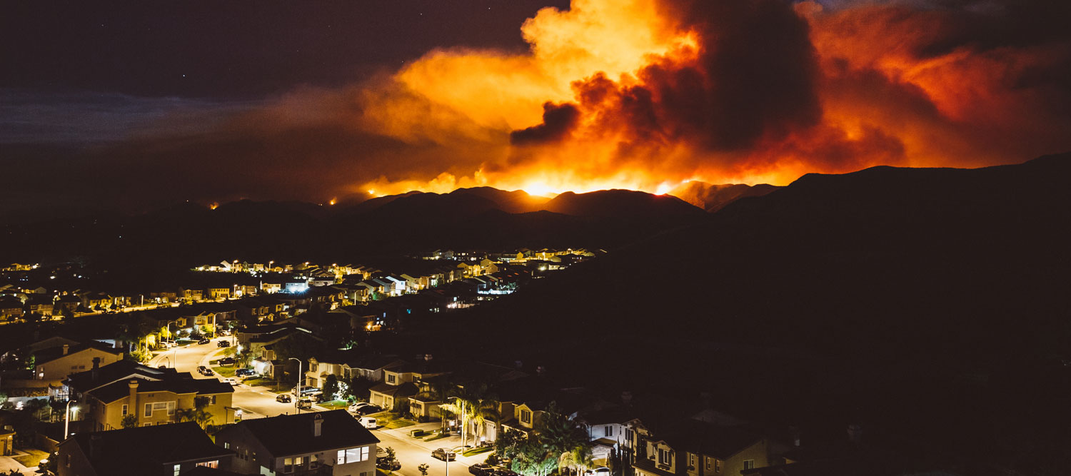
One of the most visceral manifestations of the combined problems of urbanization and climate change are the enormous wildfires that engulf areas of the American West. Fire behavior itself is now changing. Over 120 years of well-intentioned fire suppression have created huge reserves of fuel which, when combined with warmer temperatures and drought-dried landscapes, create unstoppable fires that spread with extreme speed, jump fire-breaks, level entire towns, take lives and destroy hundreds of thousands of acres, even in landscapes that are conditioned to employ fire as part of their reproductive cycle. ARISE-US recently held a very successful symposium, Wildfire Risk Reduction – Connecting the Dots for wildfire stakeholders – insurers, US Forest Service, engineers, fire awareness NGOs and others – to discuss the issues and their possible solutions. This article sets out some of the major points to emerge. The full recording of the 2 hour event is available from the link just given. The symposium has initiated an ongoing program of work by ARISE-US, and we invite participation from those with the energy and expertise to help us.
Key Findings – The Current Situation
It has been said that there is no such thing as a natural disaster, but there are natural events with disastrous human consequences because of prior decisions and lack of preparation. Wildfires demonstrate this aphorism perfectly, as symposium participants verified: Between 2005 and 2020, 1 million fires consumed 117.7 million acres in the US, with some 89,000 structures destroyed. Data for 2021 will add to these totals. Fire suppression – putting out mild to moderate fires (98% of fires[1]), rather than letting them burn, means that fuel accumulates and provides “ladders” into tree crowns.
The fires that are not suppressed are then automatically the worst case ones which, combined with very dry windy conditions, overwhelm suppression efforts. It’s the 2% of fires that cannot be suppressed that account for about 95% of the burned area. California had one fire destroy over 1 million acres in 2020, and another that has destroyed almost 1 million acres in 2021. The wildland-urban interface (WUI) becomes the critical zone where properties and lives are at risk. California alone has 2 million homes in the WUI, or 15% of its total housing stock. Many WUI zones are characterized by steep narrow roads, trees, fire friendly topology, and in many cases, master planning that takes no account of fire risk, and weak or incompletely enacted building codes. Where fires burn, landslides may well occur. Vegetation loss means that water runs off faster and roots that may be holding hillsides together are destroyed. This effectively extends risk from burning to avalanche damage and may affect structures such as bridges and roads that might otherwise be unaffected. Climate change and population growth can be expected to exacerbate all of the above trends. Existing insurance catastrophe models do not perform well with respect to wildfire behavior as now being revealed. All in all, an ugly combination of human activity and climate change! But what can be done about it?
Connecting the Dots – Towards Solutions
The symposium’s discussion of solutions began from two key assumptions. First, it will never be possible to suppress all wildfires – fires will happen, as they have for eons. Second, it will probably be politically and economically impossible to move people out of the WUI in some form of “managed retreat”, or indeed to prevent more people from moving into it. So how should we proceed?
Forest Management
Much attention has been paid recently to reviving ecological forest management (in the form of prescribed burning which simulates natural fires), as practiced by Native Americans for hundreds of years. Recent work by The Nature Conservancy and Willis Towers Watson (TNC and WTW) on ecological forest management in a 20,000 acre pilot north of Lake Tahoe showed that the practice removes ladder fuels and reduces flame height from 20-50 feet in a wildfire, to a more manageable 8 feet. The impact is visible from satellites – it is easy to pick out where earlier prescribed burning had been carried out within newer wildfire burn areas, from the visibly reduced damage and vegetation loss. The TNC/WTW study showed that ecological forest management reduces insurance losses to the point where fire insurance, in danger of becoming unobtainable, becomes economically feasible again: it reduces premiums by 20-40%. The study also considered the role of parametric insurance (where cover is based on objectively verifiable conditions – in this case the presence of fire) to pay for debris removal, landslide risk and the like, and concluded that this would be feasible too. It then demonstrated that if redirected to prescribed burns, the $21 million in premiums savings from the homes in the pilot area would generate a “virtuous circle” of permanently improved forest resilience, more affordable premiums and insurance profitability. Accordingly, the study recommended a dramatic expansion of prescribed burns. With 33 million acres of forest in CA, it will cost $5-6bn per year for 10 years to bring the fuel risk under control. As 60% of California’s forests are under Federal control it would be reasonable to expect the Federal government to help here. Also as an outcome of the study, fire insurance products based on ecological forest management principles are now being piloted.
Structure Management
If forest management is one action stream, better management of structures within the WUI is another. This includes such factors as: Planning community expansion and modernization to take account of wildfire risk; Creating and enforcing effective building codes that deal with property protection and landscaping; Structure hardening and landscape management; Ensuring water supply for firefighting and ongoing fuel management; Assessing areas of highest landslide risk in the event of wildfire and perhaps creating engineered barriers in these areas. Structure hardening alone has been shown to reduce risk to the point where existing premiums may be economically sustainable. However, long run mitigation requires a more comprehensive approach to planning, zoning and building codes, as well as establishing the processes and incentives to ensure fuel management takes place.
Data Management and Application
Data may be more available for wildfire risk reduction than is often supposed. The insurance Industry offers, at cost, very high resolution visual and near-infrared images of the entire US, which enable fuel levels and defensible spaces to be monitored (and acted upon as required), as well as expediting claims. Combining vegetation build-up with a fire weather index enables highest fire-risk zones to be seen, and increasingly, specialist forecasts predict risk months in advance at specific locations. The same data would also enable landslide risk to be seen and temporary measures to be taken until vegetation cover is re-established. Clearly, there is more that must be done. Data is too fragmented between owners, jurisdictions, insurance, locales and the federal government (hence the title of the symposium – “Joining the Dots”). That data needs to be made more consumable so that individuals can assess their risks and take appropriate action. Catastrophe models need to be revised to more accurately reflect to wildfire behavior and susceptibility. But the basic availability of data would not appear to be an issue.
Summary – All of the Above!
No one approach from those outlined above will suffice on its own. All of them will be needed and none are perfect. There are also still significant issues to be overcome, for example with financing – although more funds are becoming available; with equity, enabling all income levels to afford property hardening and insurance; with policy about land use and building code, and with managing the health risk from smoke from prescribed burns, although the smoke volumes are lower and more dispersed than from actual wildfires. But the Symposium did seem to point to ways through the wildfire issue, and that is good news. If, on behalf of your organization, you would like to participate in the continuing ARISE-US work on wildfire risk, please contact me, Peter Williams, at rpwilliams1958@gmail.com. With thanks to the Symposium’s speakers and facilitators: Dave Jones, Insurance Commissioner Emeritus, State of California; Nidia Martinez, Director Climate Risk Analysis, WTW; Molly Mowery, President, Wildfire Planning International; Jeff Czajkowski, Director, Center for Insurance Policy and Research, NAIC; Mark Finney, US Forest Service; Mark Vessely, Principal Geotechnical Engineer, BGC Engineering Inc; Ryan Bank, Global MD, Geospatial Insurance Consortium; Subarna Bhattacharyya, Co-Founder and CEO, Climformatics; Joyce Coffee, President, Climate…


